


Garmin ActiveCaptain®
4.1815.00 Reviews
App Specs
- Version
- 44.0.3459
- Updated On
- License
- Free
- Downloads
- 1,000,000+
- Developer
- Garmin
- Categories
- Maps & Navigation
- Platform
- Android, iOS
Screenshots
 Analysis by AppCompare
I find the best way to judge Garmin ActiveCaptain® is not as a replacement for a chartplotter, but as a companion to one. Its job is to make parts of boat preparation and device upkeep easier from a phone, then pass relevant planning work to compatible Garmin equipment. That distinction matters: if you do not use a Garmin chartplotter, much of the app’s appeal may not apply to your routine.
Start with a simple, repeatable workflow
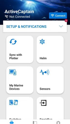
For a typical outing, I would use the app before leaving rather than wait until I am already underway. I can connect the phone to the chartplotter over Wi-Fi, review the route and waypoints I have prepared, and check that the chart and software tasks I intend to handle are in order. Once onboard, the chartplotter remains the main navigation screen; the phone is the convenient place to prepare and coordinate.
A useful habit is to separate planning from last-minute troubleshooting. Before a trip, I would open the app while the boat is stationary, connect to the plotter, and make sure the items I expect to use are available and transferred as intended. That gives me time to notice a connection issue or an unfinished update before the crew is waiting to depart. It also avoids treating a phone as a substitute for checking the equipment at the helm.
Check compatibility and settings before relying on it
ActiveCaptain is a free maps and navigation app from Garmin, but its practical value depends on the Garmin equipment in your setup. I would confirm that my particular chartplotter supports the functions I care about before building a whole routine around them. The app’s broad device support is useful, but “works with Garmin” should not be read as a promise that every feature behaves identically on every model.
I would also check the phone’s Wi-Fi connection and notification choices before a trip. The link to the plotter is central to the workflow, while alerts are only helpful if they are configured in a way that suits the boat. Smart Notifications can bring calls, texts, and app alerts to the chartplotter, but I would treat that as an optional convenience, not something to depend on for navigation or urgent communication. On a busy day, selective notifications are less distracting than sending every phone interruption to the helm.
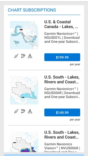
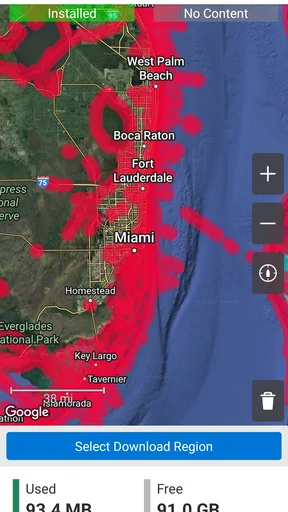
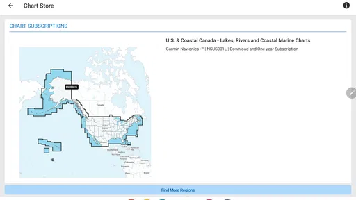
When using charts, I would make a deliberate check of what is available in the app and what is present on the chartplotter. OneChart brings chart access and management into one place, including purchasing, downloading, and updating charts. That convenience does not remove the need to verify the chart coverage and data you plan to use. I would do this at home or at the dock, not assume that a download or update will be painless just as departure time arrives.
Save time with habits, not imagined shortcuts
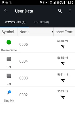
The strongest time-saver here is a repeatable sequence, not a secret trick. I would prepare a route and its waypoints on the phone, connect to the plotter, and confirm that the work has carried over before setting off. For a familiar route, that means reviewing what I already know rather than rebuilding the same plan from scratch. For a new destination, it gives me a calmer moment to think through the route before the boat is moving.
Worth Reading Before You Choose

EA SPORTS FC Mobile 26 Is a Bigger Football Game, but It Takes Time

Flipboard Shows What News Apps Must Do Beyond the Feed

Switching to Android Auto Means Rethinking Your Driving Routine

Google Calendar Makes a Crowded Week Easier to Manage

Ludo King Makes the Most of the Minutes Between Plans

Baby Panda World Brings Quick Play to Modern Phones, but Its Game Library Feels Busy
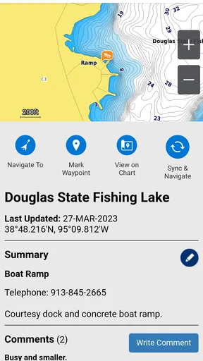
Community information can also be more useful when I treat it as a prompt for further judgment rather than an instruction. Marina and anchorage reviews may help me identify questions to check, or point me toward a place worth considering, but another boater’s experience is not a guarantee that conditions will suit my boat on a different day. I would combine those comments with my own chart review and local decision-making.
Keeping charts and plotter software current is another task that fits naturally into a maintenance routine. I would check for updates before a planned trip, allow time for the phone-to-device process, and confirm completion rather than assume that starting an update means it finished. The app makes these jobs more convenient than having to manage everything through cords and a computer, but convenience is not the same as a reason to postpone routine checks.
Know where the companion role ends
ActiveCaptain is less compelling if you want a general-purpose navigation app for driving, walking, or everyday commuting. Its purpose is tied to Garmin marine equipment, charts, and boat-trip preparation. A boater with a compatible plotter can get a practical planning and maintenance partner; someone without that equipment may be better served by a navigation option built around independent phone use.
It also asks you to manage two connected devices. Wi-Fi pairing and data transfers add a step, and that step can be frustrating if the connection is unreliable or you expect the app to behave like a fully independent chartplotter. I would keep the chartplotter as the primary navigation tool and use the app to prepare, transfer, and maintain. That is a more sensible division of labor than trying to make a phone carry the entire job.
Setting Sail with Garmin ActiveCaptain®
First off, the Garmin ActiveCaptain® app is like having a co-captain right in your pocket. It's a free, all-in-one mobile app that connects your mobile device to your Garmin chartplotter, and honestly, it's pretty slick. You can download it from both the Android and iOS stores, so no one's left stranded.
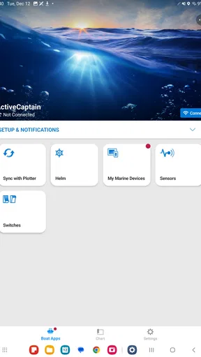
The setup is as smooth as a calm sea. Just download, connect to your Garmin chartplotter via Wi-Fi, and you're off. The app syncs up with your chartplotter effortlessly, allowing you to plan trips, review maps, and even update your software right from your phone. It’s like having a high-tech control center that you can carry around.
Features That Float Your Boat
One of the standout features is the OneChart™ function. This nifty tool lets you access all your charts and maps in one place. You can purchase, download, and update charts directly from the app. It doesn’t get much more convenient than this when you’re planning your next oceanic escapade.
Another gem is the ActiveCaptain Community. It's a hub where you can connect with other boaters to get tips, share experiences, and even check out reviews of marinas and anchorages. Think of it as your own little boating social network. And let’s not forget about the Smart Notifications. You can receive calls, texts, and app alerts directly on your chartplotter. So, you’re always in the loop, even when you’re out at sea.
Navigation Made Easy
The app excels in navigation. The Ease of creating routes and waypoints is truly impressive. You can plan your journey, and the app syncs everything with your chartplotter. It’s straightforward, and you know exactly where you’re headed.
And here’s a little bonus: the app supports a wide range of Garmin devices, so chances are, it’ll work with whatever you’ve got. The versatility ensures that almost every boater can take advantage of what Garmin ActiveCaptain® has to offer.
Keeping It Fresh
One of the biggest advantages is the ease of updating charts and software. You don’t need to fuss with cords or computers; everything is done through the app. Regular updates mean you’re always sailing with the most current information, which is crucial for safety and efficiency.
And hey, if you’re ever stuck or need assistance, Garmin’s support is just a tap away. They have a reputation for solid customer service, and it’s reassuring to know help is readily available.
Why It’s Worth a Download
So, why should you make room for Garmin ActiveCaptain® on your device? It’s simple: this app is all about enhancing your boating experience. With its wide array of features, user-friendly interface, and seamless connectivity, it’s a game-changer for anyone who spends time on the water.
Whether you’re a seasoned sailor or just getting your sea legs, this app helps you navigate more efficiently and stay connected with the boating community. It’s like having a trusty first mate who never lets you down.
In a world where technology is constantly evolving, Garmin ActiveCaptain® keeps you ahead of the curve. So why not give it a try? Your next adventure awaits, and this app is the perfect companion to chart your course.
Who will get the most from it
The best fit is a recreational boater who already uses a compatible Garmin plotter and wants to shift some preparation away from the helm. If I were heading to an unfamiliar marina, I could use the community’s comments to build a shortlist, prepare a route and waypoints on the phone, then transfer that work before departure. That makes the app useful even when I only use a few of its tools on a given outing.
It is less convincing for someone who mainly wants standalone navigation on a phone, or whose boat relies on another brand’s equipment. In those cases, an independent marine navigation app may be a more direct match. ActiveCaptain’s value comes from its connection to Garmin chartplotters, so the more central that equipment is to your boat, the more sense the companion workflow makes.
A realistic day on the water
Imagine a weekend trip to a harbor you have not visited recently. Before leaving, I would check the route and waypoints, look through relevant marina or anchorage comments, and make sure the charts I plan to use are available. At the dock, I would connect over Wi-Fi and verify that the route appears on the plotter. If anything does not transfer as expected, I can address it while stationary rather than trying to solve it during a busy departure.
On the return leg, the same routine helps keep the phone in its proper role. I can consult the plotter for navigation, while ActiveCaptain remains a place to manage connected tasks rather than a reason to split attention between screens. That distinction is especially useful when there are other people onboard: preparation can happen beforehand, leaving the person at the helm with fewer phone-related distractions.
What the ratings and version mean in practice
ActiveCaptain is free and rated for Everyone, making it straightforward to try if you already have compatible Garmin equipment. It has an average rating of 4.1 from around 6,600 ratings, with roughly 774 written reviews and over 1 million installs. Those figures suggest an established audience, but I would not treat popularity as proof that every chartplotter-and-phone combination will feel equally smooth.
The app was released on October 31, 2017, and its current version is 42.0.3266, with Android 10 as the minimum operating system requirement. I would check that requirement before installing on an older Android device. For any boater, regardless of phone, the more important practical check is whether the intended Garmin plotter supports the features they plan to use.
Where I would draw the line
There are three questions I would settle before relying on the app: is my plotter compatible with the functions I need, can I complete the Wi-Fi connection and transfer while at the dock, and are the charts I intend to use present and current? Answering those in advance turns the app into a useful part of preparation. Leaving them until the boat is underway turns minor friction into needless pressure.
I also would not treat community reviews as navigational authority or notifications as a substitute for attention at the helm. They are supporting conveniences, not the core safety decision. Compared with a standalone phone map, ActiveCaptain is more closely integrated into a Garmin boat setup; compared with using only the plotter, it offers a more convenient place to prepare and manage certain tasks. Neither comparison makes it a universal choice.
Garmin develops the app for people who want their phone and chartplotter to work together, and that focus is both its strength and its boundary. It has a clear role for route preparation, chart management, community reference, and updates, but I would still keep expectations tied to the equipment I own. Used with that mindset, it can reduce pre-trip hassle without pretending to replace good seamanship.
Pros
- User-friendly interface enhances navigation.
- Seamless integration with Garmin devices.
- Real-time boat data and stats available.
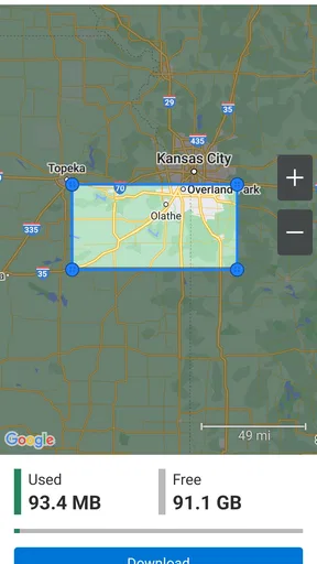
- Offline maps for uninterrupted usage.
- Customizable alerts for safety and convenience.
Cons
- Requires Garmin devices for full functionality.
- Frequent updates can consume data.
- Limited features without premium subscription.
- Occasional connectivity issues reported.
- Complex setup for first-time users.
FAQs for Garmin ActiveCaptain®
What is Garmin ActiveCaptain and what are its main features?
Garmin ActiveCaptain is a comprehensive app designed for marine navigation and management. It provides users with access to charts, planning tools, and the ability to control Garmin chartplotters remotely. The app also offers features like ActiveCaptain Community for user-generated reviews and points of interest, trip planning, and syncing across devices.
Is Garmin ActiveCaptain compatible with all Garmin devices?
Garmin ActiveCaptain is compatible with a wide range of Garmin marine devices, particularly chartplotters. However, not all Garmin models may be supported. It's important to check the compatibility of your specific device model on the Garmin website or within the app's documentation to ensure full functionality.
Does Garmin ActiveCaptain require an internet connection to function?
While Garmin ActiveCaptain can operate offline for basic functions like viewing previously downloaded charts, an internet connection is required for features such as downloading new charts, accessing the ActiveCaptain Community, and syncing data. Connectivity also enhances the app’s usability by providing real-time updates and information.
How does Garmin ActiveCaptain enhance safety during boating?
Garmin ActiveCaptain enhances safety by providing access to up-to-date charts and real-time data on weather conditions and navigational hazards. The app's syncing ability ensures that chartplotters are updated with the latest information. Additionally, the ActiveCaptain Community feature allows users to share insights on potential dangers and safe spots.
Is there a cost associated with using Garmin ActiveCaptain?
Garmin ActiveCaptain is free to download and use. However, some advanced features or chart updates may require in-app purchases or subscriptions. It's advisable to review the app's specific offerings and any associated costs within the app store or Garmin's official website to understand any potential charges.


